The Study Area: Limasawa Island
By:
Devenah Dawn Dagohoy
On
28/05/2024Reading time:
5 min
Summary:
The study covers only three out of six barangays on the island. The barangays included in this study were selected in terms of their geographical location; facing west is Barangay Triana, east and south as represented by Barangay Magallanes, and Barangay San Agustin for the north.
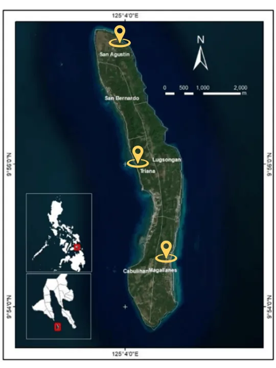
The study area comprises three barangays in Limasawa Island: Triana, Magallanes, and San Agustin. The barangays included in this study were selected in terms of their geographical location; facing west is Barangay Triana, east and south as represented by Barangay Magallanes, and Barangay San Agustin for the north. This study only covers 942 households, as shown in Table 3.1. Limasawa is a coastal municipality in the Southern Leyte province, covering a land area of 698 hectares, making up 0.39% of Southern Leyte's total area. This small island holds historical significance and is located approximately four miles off the southern tip of Leyte in the east-central Philippines. Positioned just outside the mouth of Sogod Bay, Limasawa rises to an elevation of around 200 meters. Its geographic coordinates range from 9°57'52.65" N, 125°3'37.02" E (extreme upper-left) to 9°53'41.40" N, 125°4'21.66" E (extreme lower right). Figure 3.1 below shows the imagery map of the study area.
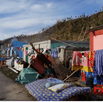
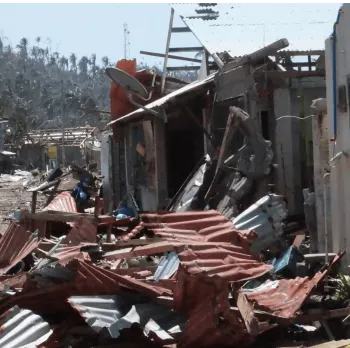
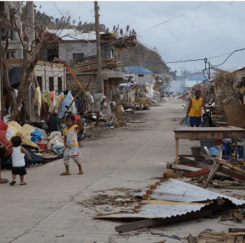
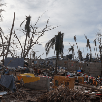
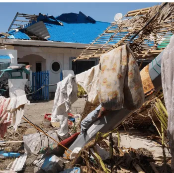
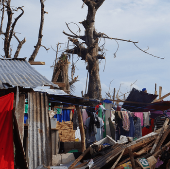
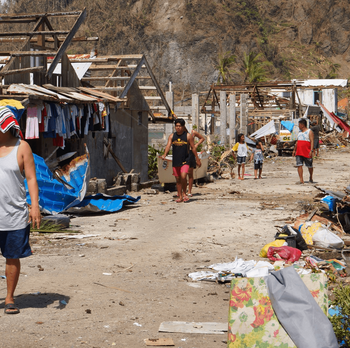
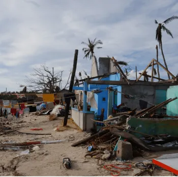
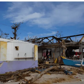
The video and the photos below show the condition of the island after Supertyphoon Odette.
Video credited to: Isko Junior (https://fb.watch/slICNoz09M/)
Photos credited to: Discover Limasawa Island