Archives
Subscribe


Cyclonic Vulnerability Maps
28.05.2024
12 min read
Devenah Dawn Dagohoy
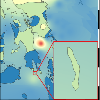
The overlay analysis tool in QGIS was used to add each criterion layer with its corresponding weights. The final cyclonic wind vulnerability map is classified into five vulnerability classes: Very Low Vulnerability, Low Vulnerability, Moderate Vulnerability, High Vulnerability, and Very High Vulnerability, as shown in the figures below. The findings revealed that the houses of the selected barangays in Limasawa Municipality exhibit low to moderate vulnerability to tropical cyclonic winds.
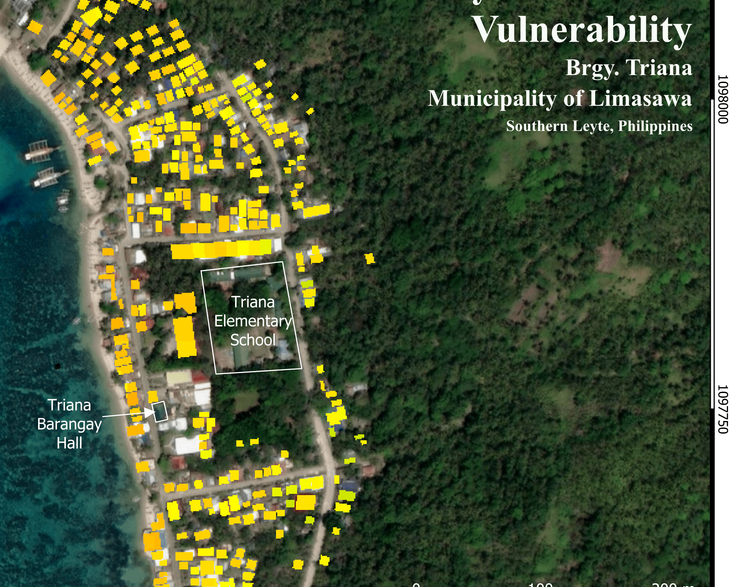
Parameter Maps
28.05.2024
Devenah Dawn Dagohoy
Cyclonic wind vulnerability parameters were mapped using QGIS using the established feature weight of each parameter. The study generated 17 parameter maps and three cyclonic wind vulnerability maps. All the building attributes and the presence and number of obstructions were mapped per barangay, while the remaining location attributes presented the whole municipality.

The Study Area: Limasawa Island
28.05.2024
Devenah Dawn Dagohoy
The study covers only three out of six barangays on the island. The barangays included in this study were selected in terms of their geographical location; facing west is Barangay Triana, east and south as represented by Barangay Magallanes, and Barangay San Agustin for the north.